Projects
Home
Projects
About
Mobile geo-data collection systems
Open source mobile data collection solutions using QFieldCloud on your own server.
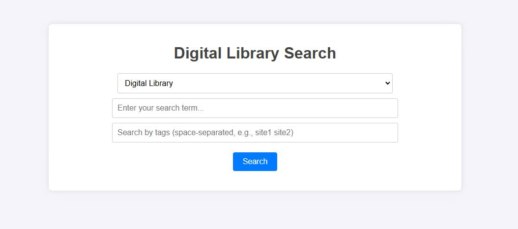
Document search engine
Creating an in-house search engine for a 'digital library' utilising Python, Golang, Gin and Postgres
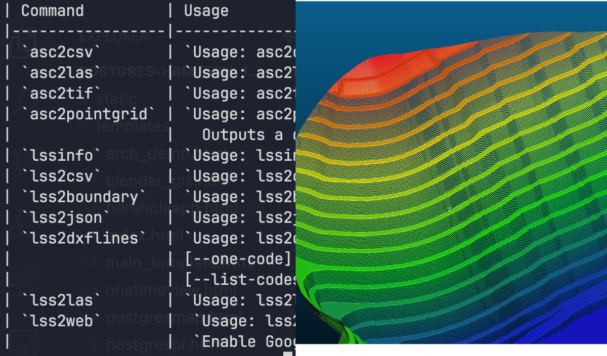
ASCTools
Geospatial CLI tools for working with .asc files and other proprietary formats.
Data logger automation app
Creation of multi-platform app for handling and storing borehole water level data allowing for cloud access using PostgreSQL.
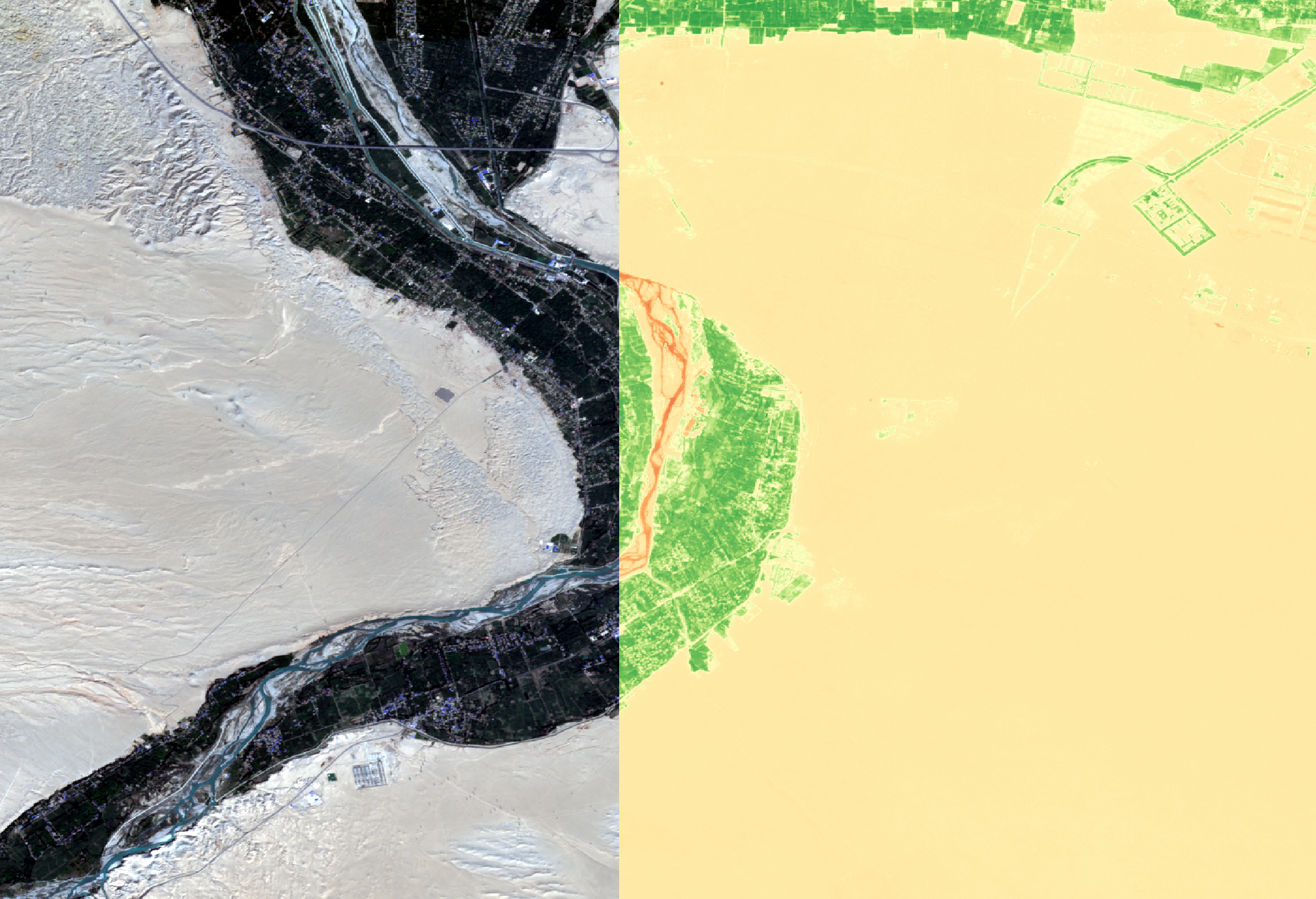
Sentinel-2 QGIS Integrated Downloads
QGIS tool for bulk downloading/processing Sentinel-2 data using Sentinel hub.
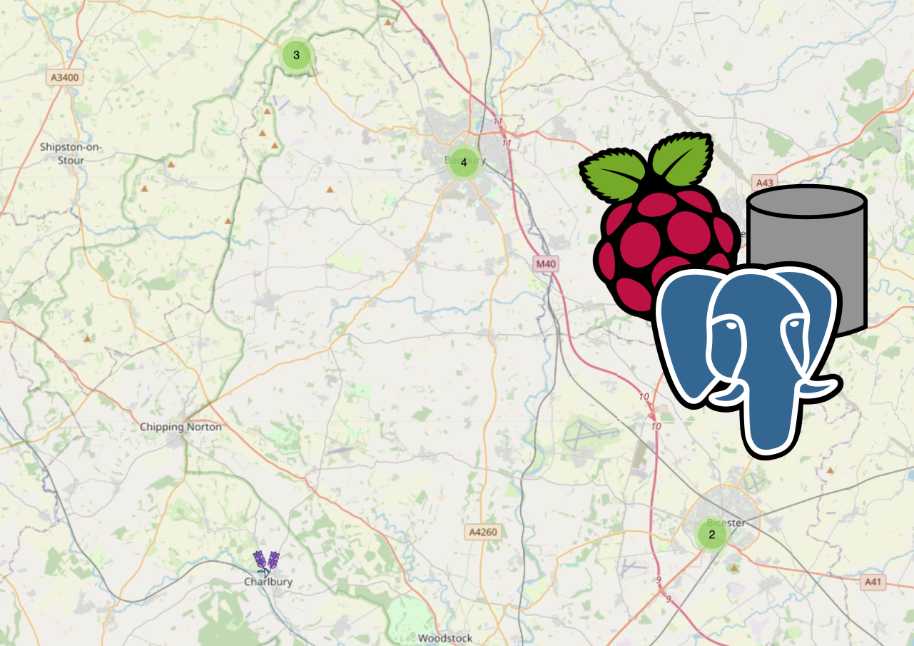
Raspberry Pi, Postgresql + Leaflet
Setting up a webmap using leaflet using Postgresql + PostGIS for live updates directly from GIS hosted on a Raspberry Pi.
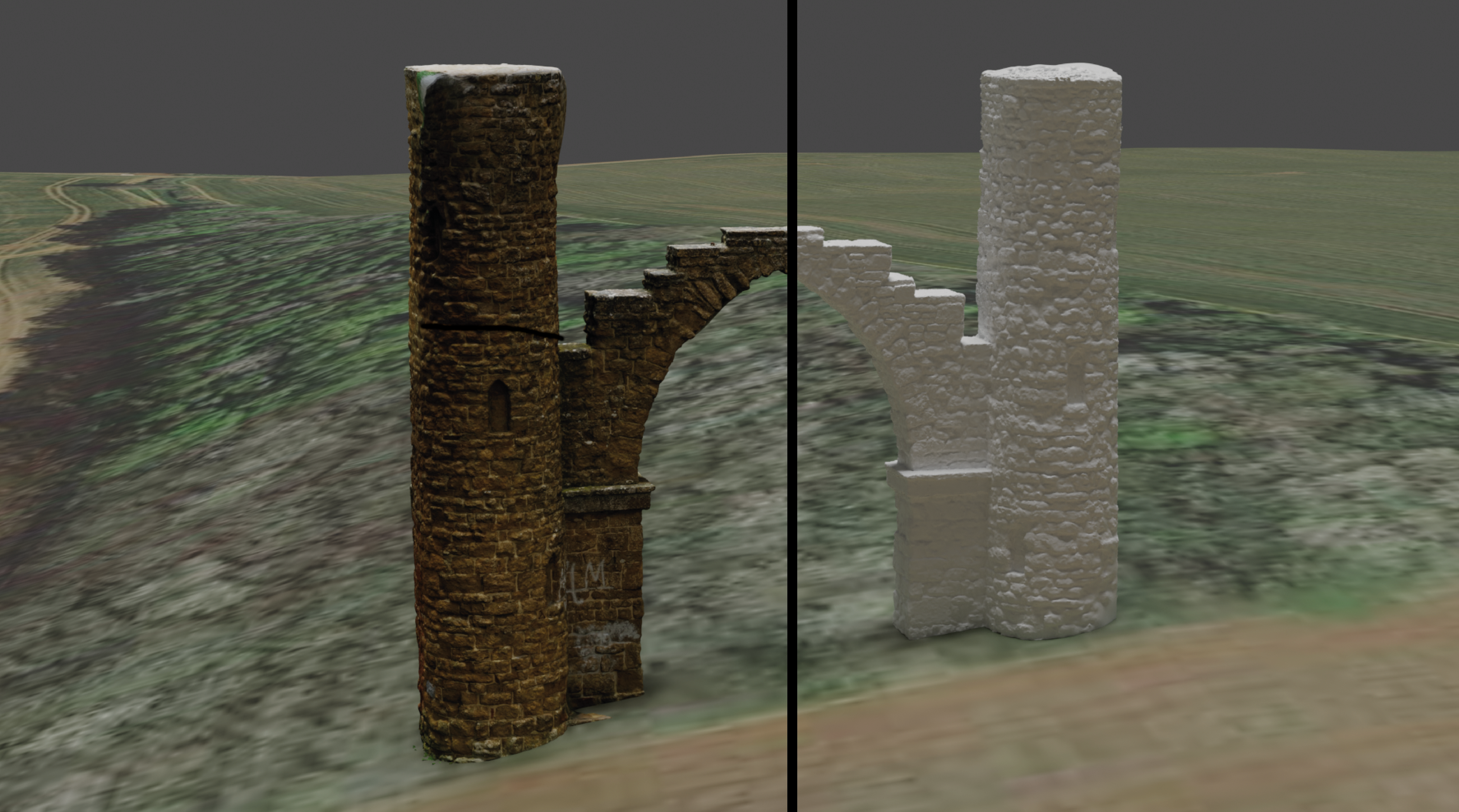
Blender GIS Addon
Installation and quick overview for the Blender GIS Addon for visualising geospatial data.
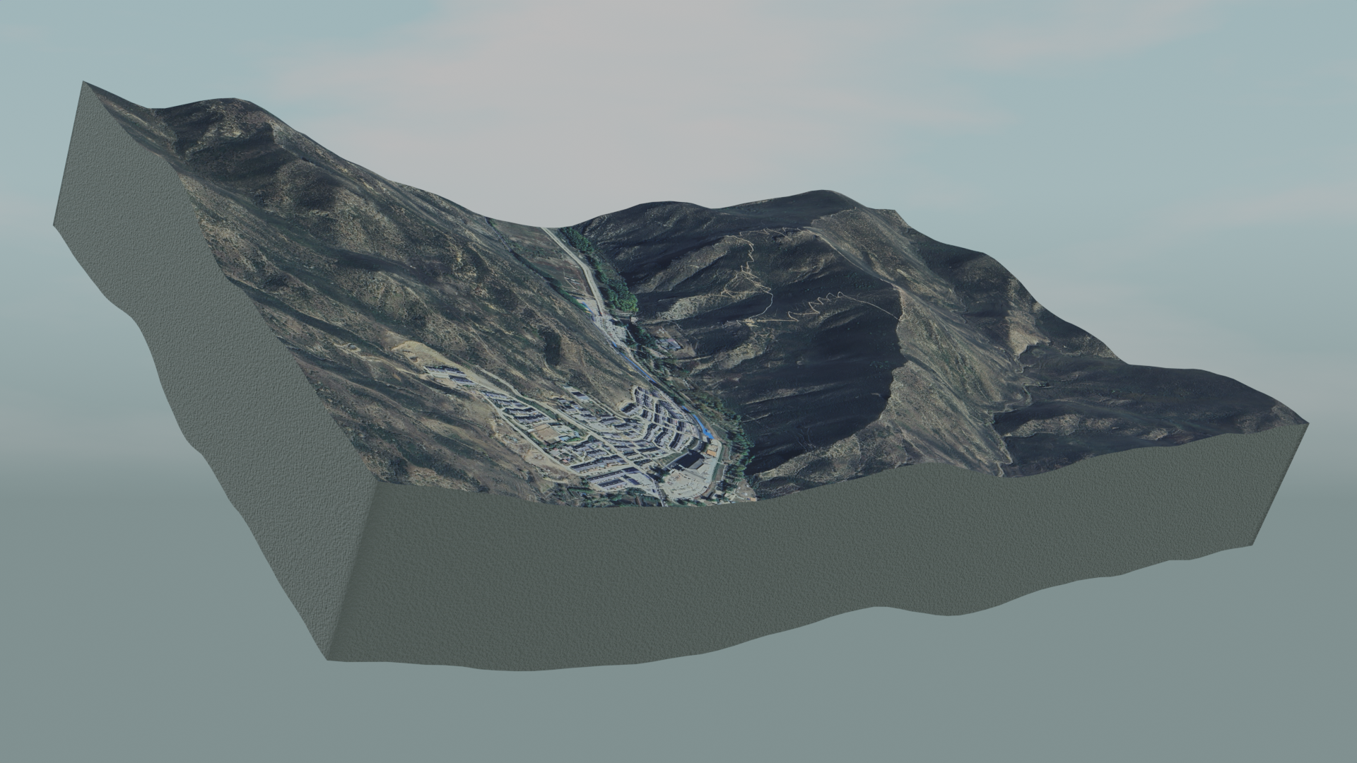
Drone captured 3D Mesh Visualisation
Using drone captured imagery to recreate 3D models as meshes. Creating scenes for viewing in Blender or on the web.